
The Hawkeye State is sometimes referred to as “flyover country,” the middle part of the United States
travelers pass over on their way to and from the coasts. Others speed across on freeways. But Iowa
is well worth driving the backroads, particularly in summer when vibrant green, perfectly manicured
fields of corn and soybeans blanket hills across the state. Add covered bridges, historic main streets
and majestic views of the Mississippi and Missouri rivers and you’ve got several quintessential All-
American road trips. One route we won’t cover in this article is the Lincoln Highway, the nation’s first
cross country road for automobiles. Established in 1913, it ran from New York to San Francisco. We’ll
include Iowa’s segment in a future article profiling the entire Lincoln Highway.
- Great River Road – All-American Road
- Loess Hills – National Scenic Byway
- Western Skies
- White Pole Road
- Covered Bridges
Great River Road – All-American Road – 330 miles (+ 52-mile side trip to Field of Dreams Movie Site)

There are many superlatives to describe the Mississippi River. It’s one of Earth’s largest river systems
in size and habitat diversity. In North America, it’s a major migration route for birds and fish. And it’s
one of the world’s most important commercial waterways. Unlike more isolated, less developed major
rivers around the globe, roads generally parallel the entire 2,552 miles of the Mississippi. Called the
Great River Road, you can follow the river’s length from its Minnesota headwaters to the Louisiana
delta.
Iowa’s section of the Great River Road is one of the best, blending Native American history and high
bluff overlooks with aquariums, a cave tour, nature preserves and a beloved baseball field.
By the time the Mississippi River reaches the Hawkeye State, it’s already meandered several
hundred miles through Minnesota. Starting in the far northeast corner of Iowa, State Highway 26
enters New Albin. Minneapolis, the closest major city, is 180 miles northwest. Des Moines lies 240
miles southwest. A mix of county, state and US highways make up the route. Road numbers change
as you drive south along the river so always keep watch for the familiar Great River Road sign.
From New Albin, it’s 11 miles to the next small town, Lansing, which has a bridge crossing to
Wisconsin. This part of Iowa is especially picturesque with hills, river valleys and limestone bluffs
covered in hardwood forest, meaning summer shades of green and magnificent fall colors. You’re
also now driving through the Upper Mississippi River National Wildlife and Fish Refuge. The Driftless
Area Education and Visitor Center has interpretive exhibits and information on recreational
activities such as hiking, canoeing, kayaking, fishing and hunting.
From Lansing, it’s 24 miles south to Effigy Mounds National Monument. Humans have lived in the
region for more than 10,000 years and the monument has 206 prehistoric mounds, from 850 to 2,500
years old. Their origin and purpose are unknown although the oldest, conical-shaped mounds were
used for burials. Some 1,400 years ago, mounds in the form of bears and birds were created. The
monument is an important Native American site with forest hiking trails and high bluffs overlooking the
Mississippi River. However, the animal shapes can be hard to make out when standing so close.
They were likely visible from far away, particularly when trees were removed. Be sure to stop at the
visitor center for exhibits and information.
A few minutes south lies one of the many attractive towns along the river. Founded in the mid-1800s,
McGregor’s brick buildings house restaurants and shops selling gifts, antiques, books, clothes and
ice cream. Across the river is the much larger Prairie Du Chien, Wisconsin with fast food, big box
stores and several campgrounds.
The camping spot with the best views is Pikes Peak State Park, just south of McGregor. With 11
miles of trails, the park offers a variety of hiking terrain. Easy walks lead to Bridal Veil Falls and bluff
overlooks with sweeping views of the confluence of the Mississippi and Wisconsin rivers. At 1,130
feet, the park has the highest bluff along the Mississippi and like Colorado’s Pikes Peak, is also
named after Zebulon Pike, the explorer and U.S. brigadier general.
From Pikes Peak State Park, it’s 18 miles to Guttenberg, another interesting riverside town and a
good place to see the inner workings of the Mississippi. There are 29 dams on the Upper Mississippi
River that create pools deep enough for large towboats to navigate. The dams have locks which raise
and lower vessels between levels. In operation since 1937, Lock & Dam Number 10 is in
Guttenberg, with a viewing platform where you can watch ships and boats move through the locks.
The nearby Lockmaster House Heritage Museum is the last remaining lockmaster house on the
Upper Mississippi River featuring artifacts, antiques, photos and other memorabilia. The Guttenberg
Fish Hatchery also deserves a quick visit. Located downtown, it raises northern pike fry for the Iowa
Department of Natural Resources and has an aquarium with local fish species and exhibits.
The granddaddy of Mississippi aquariums is farther down the river some 40 miles. Chartered in 1837,
Dubuque is Iowa’s oldest city and one of the first European settlements west of the Mississippi River.
Today, this comfortable, enticing midsize city features restored brick buildings, colorful murals,
breweries, art galleries and a strong theater and music scene. The first-rate National Mississippi
River Museum & Aquarium has numerous indoor and outdoor displays on a large campus. Native
American history, river heritage, the National Rivers Hall of Fame, dugout canoes, river otters and a
slew of wildlife and nature exhibits make it a top draw.
Another major attraction in the area is a 52-mile roundtrip detour west of Dubuque. The Field of
Dreams Movie Site in Dyersville is where many scenes from the beloved 1989 baseball classic were
filmed. You can run the bases, play a pickup game, tour the Kinsella farmhouse and walk out of rows
of corn, just like the ghosts of baseball legends. And if you’re tired of camping, consider the “Kinsella
Experience” where you spend the night in the three-bedroom home.
Back in Dubuque, the Great River Road continues south four miles to Mines of Spain, a large
recreation area of woods and prairies that also houses the E.B. Lyons Interpretive and Nature
Center. Although there’s no camping, other activities include canoeing, kayaking, picnicking, hunting,
hiking and spectacular photography of the Mississippi River, downtown Dubuque and Illinois from
bluff overlooks.
From high above, it’s a couple of miles to an underground adventure, Crystal Lake Cave. Discovered
in 1868, the cavern opened to the public in 1932. Today, guides lead small groups through the cave’s
well-lit passages on a ¾-mile long tour.
From Crystal Lake Cave, the Great River Road follows US 52 south. In eight miles, look for the
photogenic Saint Donatus Church on the left as you pass through the town of the same name. The
church looks even more impressive from a distance, framed by farmland and forest as you climb the
hills to the south. From Saint Donatus, it’s 10 miles to Bellevue, another attractive, historic riverside
town. Just south is Bellevue State Park with more impressive river views, hiking trails, camping and
a nature center and butterfly sanctuary.
From Bellevue, stay on US 52 until it reaches US 67 and continue south to Clinton, a large town with
all the necessities. Bellevue to Clinton is 37 miles and then drive another 23 miles to LeClaire where
the Buffalo Bill Museum is worth a peek. The iconic frontiersman, US Army scout and showman
was born in LeClaire in 1846. William F. Cody was an expert marksman, earning his nickname while hunting buffalo, aka American bison. In the late 1800s, Buffalo Bill’s Wild West show began touring
the United States and Europe and is largely credited with creating many of the early stereotypes of
the American West.
Leaving LeClaire, the Great River Road intersects busy I-80 before continuing south into Bettendorf
and then Davenport, two of the four Quad Cities. The others, Moline and Rockford, are located across
the river in Illinois. After passing through downtown Davenport, the Great River Road follows IA 22
south to the next highlight. The Nahant Marsh is a 382-acre preserve next to the Mississippi River.
There’s an education center and trails through the wetlands. Birding is popular as well as
photographing the hundreds of blooming summertime water lilies.
From Nahant Marsh, it’s 15 miles to Wildcat Den State Park, another beautiful place to hike and
camp. Many visitors come to see the Pine Creek Grist Mill, the oldest working grist mill between the
Mississippi River and Rocky Mountains. While Wildcat Den showcases forest and sandstone bluffs,
drive five miles farther to Fairport State Recreation Area which offers camping and recreational
activities next to the Mississippi River.
From Fairport, follow the river seven more miles to Muscatine. In the late 1800s, the Mississippi was
the ideal habitat for huge clam beds, creating the world’s largest pearl button industry. Overfishing
and the development of plastic buttons eventually ended Iowa’s pearl button business. Today,
Muscatine is a pretty riverside town with restaurants and shops. To learn more about the clams and
button industry, visit the informative, elegant National Pearl Button Museum.
Next, the Great River Road travels 24 miles to the Toolesboro Indian Mounds National Historic
Landmark. Iowa’s Hopewell culture flourished for five hundred years, from about 200 BCE to 300
CE. This site preserves several large burial mounds and includes a small museum and prairie
demonstration plot.
From the mounds, it’s 27 miles to Burlington, a large town with a peculiar attraction. While San
Francisco has Lombard Street, many in Burlington consider Snake Alley to be the world’s crookedest
street. Guinness World Records gives Lombard Street the nod but you should still check out Snake
Alley. Built in 1894, it’s probably safer to walk up and down than drive an RV! Nearby, the Heritage
Center Museum is housed in a restored library built in 1898. Highlights include Native American
relics, immigrant stories and artifacts plus a first-rate fossil collection of ancient marine animals called
crinoids.
From Burlington, historical interpretation continues 19 miles down the Great River Road at Old Fort
Madison. This living history museum is a captivating replica of the original, erected in 1808 as the
first American military fort in the upper Mississippi region. Old Fort Madison was a major trading post.
Guides in period uniform and costume demonstrate trade, clothing, equipment and weaponry.
The town of Fort Madison has well-preserved historic storefronts from the late 1800s. It also lays
claim to the world’s largest and Mississippi River’s only remaining double swing-span bridge with
an upper level for cars and a lower part for trains.
Another 25 miles and the Great River Road reaches its final Iowa town, Keokuk. Look for the George
M. Verity Riverboat Museum on the riverfront. In 1927, the US government built the paddle boat
upstream in Dubuque to revive river transportation and move barges from St. Louis, Missouri to St.
Paul, Minnesota. In 1961, the George M. Verity was retired from service and donated to Keokuk.
From here, the Great River Road crosses into Missouri, where we’ll continue the journey soon.
Loess Hills – National Scenic Byway – 220 miles (+ 70 miles for side trips)

This far-west Iowa road trip parallels the Missouri River from the Missouri state line to Akron, just
across the river from South Dakota. The Loess Hills are the other significant geographical feature
here. 12,000 to 15,000 years ago, winds deposited tiny soil particles. Called loess, the windblown
sediment covers most of the Midwest, making some of the world’s richest farmland. In Iowa, the
particles also formed 200-foot-high bluffs that follow the Missouri River for about 200 miles, reaching
up to 15 miles wide. Only China has comparable loess deposits.
The byway starts in Hamburg in the southwest corner of Iowa, 55 miles southeast of Omaha,
Nebraska. Follow Bluff Road six miles north to the 2,000-acre Waubonsie State Park. With its
expansive views, the park gives a great overview of the Loess Hills and the plains of Nebraska and
Missouri River in the distance. The Sunset Ridge Nature Trail runs through the heart of the park and
is part of an extensive trail system for hiking, mountain biking and horseback riding. Camping, fishing,
hunting and snowmobiling are also popular.
Road numbers change often along this route, so follow the Loess Hills Scenic Byway signs and your
GPS. From Waubonsie State Park the byway passes near Sidney, home to the 100-year-old Sidney
Iowa Championship Rodeo. Bull and bronc riding, steer wrestling, team roping, barrel racing and
mutton busting are some of the events held annually in late July or early August.
Back on the byway, continue 30 minutes north to Mile Hill Lake, west of Glenwood. Another scenic
overlook has views of the Loess Hills. The park’s lake has fishing plus there’s hiking and hunting.
From Mile Hill Lake, it’s 20 miles to Council Bluffs, a medium-sized city which sits directly across the
river from Omaha, Nebraska’s largest metropolis. Council Bluffs is a crossroads. Busy I-80 passes
east and west while I-29 goes north and south. Railroads made the city one of America’s largest rail
centers, which you can learn about at the Union Pacific Railroad Museum downtown. From the
museum, it’s a ten-minute walk to the Historic General Dodge House, the 1869 Victorian mansion of
Grenville Dodge, a Civil War major general who also achieved fame and fortune as “the greatest
railroad builder of all time.” And before that, in 1804 Meriwether Lewis and William Clark led their
famous expedition exploring the American West. In July of that year, Lewis and Clark arrived in
Council Bluffs. Southwest of downtown, the Western Historic Trails Center has exhibits on the duo
as well as the Oregon, California and Mormon trails. Run by the National Park Service, there are also
walking and biking paths along the Missouri River. North of the city, the Lewis and Clark Monument
has scenic river views and commemorates the men’s historic meeting with the Otoe and Missouri
tribes.
North of Council Bluffs, there are several outdoor recreation areas along the byway. Hitchcock
Nature Center offers camping, hiking, hunting and a 45-foot-high birds of prey observation tower on
1,500 acres of prairie, savanna and woodlands. This is also near the start of the Western Skies
Scenic Byway where you’ll find:
- DeSoto National Wildlife Refuge
- Wilson Island State Recreation Area
- Watson Steam Train & Depot
- Harrison County Historical Village & Iowa Welcome Center
From the Harrison County Historical Village in Missouri Valley, follow the Loess Hills Scenic Byway
north to the Murray Hill Scenic Overlook with more panoramic views that’s popular with birders and
budding botanists who come to observe the wildflowers and yucca, a plant somewhat oddly out-of-
place as its more often associated with the western U.S.
From Murray Hill, continue nine miles to Preparation Canyon State Park, one of the more rugged
parks in the heart of the Loess Hills with picnicking, backcountry hiking and ten hike-in camping sites.
From Preparation Canyon, it’s 22 miles to Lewis and Clark State Park, another historic spot from the
1804 expedition. There’s a visitor center with exhibits and a full-sized reproduction of Lewis and
Clark’s keelboat. The lakefront park has boating and fishing with a modern campground, playground
and beach.
Lewis and Clark State Park is a bit of a detour west of the byway so head east 11 miles through
Onawa and Turin to get back in the Loess Hills. From Turin, it’s 50 miles north to Sioux City with
grocery stores, fast food, RV supplies and more. By now, it’s clear this road trip has a lot of
outstanding natural areas and Stone State Park is no exception. Located six miles northwest of
Sioux City, this “urban wildlife sanctuary” features hiking, biking and camping. The park’s top
attraction is also one of the best places in Iowa to learn about the Loess Hills. Inside the Dorothy
Pecaut Nature Center are prairie, wetland and woodland exhibits with native reptile and fish
displays, a bird viewing area and butterfly and wildflower gardens.
Another outstanding nature preserve is 12 miles north of Stone State Park. Broken Kettle
Grasslands is Iowa’s largest remaining prairie where more than 200 bison roam, many descending
from a small herd reintroduced to the area in 2008. Along with the nearby Five Ridge Prairie, there
are numerous hiking trails with great views.
From here, the byway leaves the Loess Hills, ending ten miles north in Akron. After all the driving,
hiking and camping, consider going another 22 miles east to Le Mars, where the Blue Bunny factory
makes “more ice cream than any other location on earth!” The company operates the Wells Visitor
Center & Ice Cream Parlor in downtown with interactive displays and dozens of flavors of ice cream,
sherbet and sorbet.
Western Skies – 145 miles

This road trip combines two state scenic byways, Western Skies and White Pole Road, as it explores
west-central Iowa. Running north of and parallel to I-80, the route is a relaxing alternative to the hectic
freeway, often crowded with semitrucks. The real joy of this itinerary is the sum of its parts. No one
stop really stands out but collectively, the various roadside attractions, nature preserves and historic
sites create a warm and fuzzy, small town Americana experience.
Located 30 minutes north of Omaha, the Western Skies Scenic Byway starts near the Nebraska/Iowa
border in Missouri Valley. This is also where Western Skies intersects the Loess Hills Scenic Byway
(article above). Just west of town is the DeSoto National Wildlife Refuge featuring bottomland
forests, tall grass prairie and wetland habitats. The Missouri River separates Iowa from Nebraska and
the refuge is centered around DeSoto Lake, an oxbow lake that was once a bend in the river.
Migrating waterfowl and bald eagles make birding a top draw along with fishing and hunting. At the
visitor center, you can see a collection of 250,000 artifacts excavated from the buried wreck of the
Steamboat Bertrand which sank in 1865.
DeSoto is a day-use only area but if you want to say you’ve roughed it where the explorers Lewis and
Clark camped in 1804, drive immediately south of the refuge to Wilson Island. The state recreation
area offers campsites, hiking trails and picnicking set among cottonwood trees.
From here, Missouri Valley is 10 miles northeast. Near downtown, Watson Steam Train & Depot is a
fun place to take kids. It’s a replica of a small-town depot and includes artifacts, displays and a major
collection of miniature brass locomotives. A restored steam train and 2013 Union Pacific diesel
replica offer rides from May through October.
Heading northeast on US 30, it’s four miles to the Harrison County Historical Village & Iowa
Welcome Center where quilts, carriages, barbed wire and several restored buildings are on exhibit.
This is a great place to ask questions and pick up brochures for scenic byways as well as the Lewis
and Clark National Historic Trail. Outside is Harrison County’s Freedom Rock, a colorfully painted
tribute to military veterans. All of Iowa’s 99 counties have one and the rock that started it all will be
visited later on this road trip when we drive White Pole Road.
From the Welcome Center, continue northeast on US 30 for 14 miles to Woodbine and then drive 15
miles east to Panama. Signs and GPS will help you navigate as road numbers change while this
byway passes through rolling hills of symmetrical corn rows, punctuated by silos and barns. Look for
giant quilts, too. Though the trend started in Ohio, today many Iowa barns and other buildings sport 8-
foot wooden quilts in cheerful patterns and colors.
Panama and then Westphalia, another four miles east, were founded by German immigrants and
feature architecturally impressive churches. Behind St. Boniface in Westphalia there’s a German
Heritage Park with a few historic buildings and statues. Around town, many signs are labeled
“Strasse,” German for street.
From Westphalia, there are several nearby recreational opportunities. Rosman Glendale Golf
Course is a 9-hole public golf course that’s 4.5 miles east of town. Continue another 5 miles to
Dinesen Prairie State Preserve, a 20-acre remnant of native tallgrass prairie that’s “never been
turned by a plow.” It features 114 types of plants and a variety of birds and animals. Another 13 miles
is Prairie Rose State Park. Surrounded by hills with a large lake, it’s popular for boating, hiking and
fishing. You can camp here, too. Harlan isn’t too far away, either. It’s the largest town in the area with
fuel, pharmacies, restaurants and such. It’s worth repeating that you’ll need GPS because there’s no
direct route to any of these places. Prepare to zigzag!
While German influence is apparent around here, Danish is also prevalent. From Harlan, drive east to
Kimballton where you’ll be greeted by Danish flags, velkommen (welcome) and posthuset (post
office). Hans Christian Andersen’s The Little Mermaid & Statue Garden features a replica of the
famous sculpture in Copenhagen plus eight more statues depicting his best-loved fairy tales.
Kimballton is also home to Audubon County’s Freedom Rock, where you’ll see The Little Mermaid
holding Danish and American flags.
From Kimballton it’s three miles south to Elk Horn where Kringleman Pastries sells Danish treats.
The town has two major attractions. Built in Denmark in 1848, America’s only authentic working
Danish Windmill sits prominently on Main Street and is open for tours. And close by the Museum of
Danish America has historical exhibits, a genealogy and education center and hip design store in an
impressive Danish-style structure.
From Elk Horn, it’s 12 miles east to Hamlin and Darrell’s Place, a nondescript building with a
crowded parking lot. For four decades, the family-owned restaurant has been serving homecooked
meals, including “Iowa’s #1 Breaded Pork Tenderloin.” Believe me, it’s delicious and affordable.
From Darrell’s Place, be sure to drive five minutes north to see Albert, the “World’s Largest Bull” in
the town of Audubon. Made of steel and concrete, right down to his gonads, Albert stands 30 feet tall
and lives in a park with a modern campground. This is also the start of the T-Bone Trail which runs
21 miles south and is popular with bikers, walkers and runners.
From Audubon, it’s 32 miles south and then east to Panora and the Guthrie County Historical
Village and Museum with several restored historic buildings including a train depot, general store,
law office and log cabin.
From Panora, the byway continues south. In 10 miles, look for the 81-acre Nations Bridge Park
where you’ll find camping, picnicking, kayaking, fishing, disc golf and horseshoes. The park has
several nature trails for bird and wildlife watching. It’s another five miles south to Stuart where
Western Skies meets White Pole Road and this road trip continues in the article below.
White Pole Road – 26 miles
This byway makes a great extension to the Western Skies Scenic Byway (see above). And since
White Pole Road parallels I-80, it’s a calmer, much more interesting alternative to the freeway on your
way to and from bustling Des Moines, the state’s capital and largest city.
From downtown Des Moines, it’s 30 miles on I-80 west to Dexter and the start of White Pole Road.
It’s named after an early 1900s dirt road that followed the train tracks west. Today the byway runs
near I-80 for some 26 miles. White Pole Road was Iowa’s first certified auto route. Towns were
located every few miles with white poles marking the way, encouraging motorists to travel the “Great
White Way.” White Pole Road is a great trip for kids because it’s a short and sweet treasure hunt that
includes a chocolate shop.
The first gem to find is Dexter’s Roundhouse. Built in 1916 and listed on the National Register of
Historic Places, the Roundhouse is made of hollow blocks and has a 30-foot-high dome that’s only
supported by the circular wall. This unique structure is believed to be the only building of its kind in
Iowa and possibly the nation, and it still functions as a community center hosting all kinds of events.
Five minutes north of Dexter are two other intriguing sites. As you drive Dexfield Road, look for a
roadside marker and plow on the right. President Harry Truman, his wife Bess, daughter Margaret
and 100,000 other fans came to Dexter for the 1948 National Plowing Match. A little farther north
and you’re at Racoon River near what used to be Dexfield Park, site of a 1933 shootout between law
enforcement and the five-member Barrow Gang. Clyde Barrow and his girlfriend Bonnie Parker were
its two most infamous members, committing at least a dozen murders and a bunch of robberies. Along with W. D. Jones, Bonnie and Clyde escaped this shootout but Clyde’s brother, Buck died from his wounds and his wife, Blanche was blinded in one eye and went to prison. The FBI calls Bonnie and Clyde the “most notorious crime couple in American history” and the 1967 film classic starring Warren Beatty and Faye Dunaway is a must-watch, although it might be too intense for the kids! The Dexter Museum has exhibits on both the shootout and plowing match. Drew’s Quality Chocolates predates both events. The store has been handmaking chocolates in the same Dexter location by the same family since 1927.
From Dexter, continue west five miles to Stuart, where White Pole Road intersects the Western Skies
Scenic Byway (see article above). Look for the old First National Bank that Bonnie and Clyde
robbed in 1934. Stuart has a quaint downtown with shops and the attractive Historic Clocktower
Building. A couple of blocks away is Saints Center, once voted the “Most Beautiful Church in Iowa”
by Des Moines Register readers. After an arsonist set fire in 1995, it was restored and is now a community cultural facility and event venue. Another renovation worth a photo is Stuart Depot, a refurbished 1879 railroad depot.
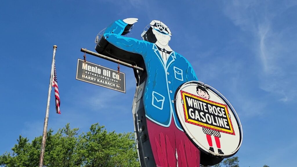
From Stuart, White Pole Road continues west five miles to Menlo. Look for the Friendly Gas Station
Man on the right. The neon sign has been welcoming motorists since 1934. Then, past town take a
left onto State Highway 25 where you’ll cross I-80 before arriving at Freedom Rock, about 5.5 miles
from Menlo. Following the Western Skies Scenic Byway, we passed several of these boulders, as
detailed in the previous article. This is the original Freedom Rock, covered with patriotic scenes
honoring military servicemembers. It gets repainted every year with a different thank you to veterans.
Artist, Iowa native and State Representative Ray “Bubba” Sorensen II was inspired by the movie
Saving Private Ryan to paint this first giant stone in 1999. He’s now created a Freedom Rock in all of
Iowa’s 99 counties.
From Freedom Rock, zigzag 5.5 miles west where White Pole Road enters Casey. The visitor center
and museum are located inside the renovated St. Joseph’s Catholic Church which has beautiful
stained glass windows. The huge mural at Veterans Memorial Wall & Park Gallery is also worth a
look.
From Casey, it’s eight miles to the byway’s end in Adair, known for its brick streets and buildings.
Opened in 1924, the Adair Viaduct is a three-span arch bridge listed on the National Register of
Historic Places. And just to the southeast of the small downtown is the Smiley Face Water Tower.
Another five minutes west of Adair marks the spot where Jesse James and his gang carried out the
world’s first moving train robbery in 1873. The outlaws thought $75,000 of gold was aboard but
only found $2,000 in the train’s safe. So, they robbed the passengers and made off with another
$1,000.
Covered Bridges – 85 miles

Southwest of Des Moines is a day trip that travels from Iowa’s capital and largest city to a picturesque
small town famous for its covered bridges and Hollywood connections. Winterset is the birthplace of
John Wayne. It’s also the setting for The Bridges of Madison County, a 1995 film based on Robert
James Waller’s bestselling novel. The movie was directed by Clint Eastwood who costarred with
Meryl Streep. Both the bridges and John Wayne play a significant role in this scenic route.
From downtown Des Moines, it’s an easy 40-minute drive to Winterset. Erected between 1870 and
1884, there are six bridges to see in and around town. The covers were built to protect the wooden
decks and trusses from rain and snow, preventing decay and rot. And while each bridge is amazing, they all kinda look the same. Something to keep in mind as you’re planning the day. You can walk
across each bridge; Cedar Bridge is the only one that’s drivable.
- Hogback Bridge (1884): Located on a well-maintained gravel road six miles northwest of Winterset, this bridge is 97 feet long and lies in its original location.
- Cedar Bridge (1883): At 76 feet long, this is the only bridge you can drive across. It’s on a paved road that changes to gravel not far from the bridge. Located 3.5 miles northeast of Winterset, Cedar Bridge was moved to this spot in 1921. This is the most famous bridge as it’s pictured on The Bridges of Madison County book cover and was featured in the film. Sadly, the original bridge is gone. Nearly destroyed by arson, it was rebuilt and re-opened in 2019.
- Holliwell Bridge (1880): This bridge was in the movie and still sits in its original location, off a gravel road 5.5 miles southeast of town. It’s also the longest bridge at 122 feet.
- Imes Bridge (1870): The oldest of the surviving bridges in the area, 81-foot-long Imes sits right next to State Highway 251 in St. Charles, 13 miles east of Winterset. It’s another mile east to I-35 which goes directly north to Des Moines.
- Roseman Bridge (1883): Another film star, this beauty is 107-feet-long and still lies in its original location, 9.5 miles southwest of Winterset on a gravel road. Nearby Pammel Park features the Harmon Tunnel. Built in 1850, it cuts through a limestone ridge. The park is set in woodlands along the Middle River and offers camping, hiking, kayaking, canoeing, tubing and fishing.
- Cutler-Donahoe Bridge (1870): This 79-foot-long bridge is the only one located in town. It was moved to Winterset’s City Park in 1970. The park also features excellent views of the countryside from Clark Tower, a castle-like structure a mile south of the bridge.
Founded in 1849 and anchored by the striking Madison County Courthouse, downtown Winterset is
predictably charming with boutiques, restaurants, a brewery and the nostalgic Iowa Theater, showing
new movies Fridays through Sundays and classic films on Wednesdays.
Winterset’s most famous son is celebrated at the John Wayne Birthplace & Museum, the world’s
only museum dedicated to the iconic actor. Even if you aren’t a John Wayne fan, the museum is well
done and engaging, particularly for movie buffs.
One of America’s great art forms and a hobby that’s growing in popularity around the world, the Iowa
Quilt Museum has historical displays and a gift shop. But the best part is the incredibly colorful
rotating exhibits featuring best-in-class quilters.
Just south of downtown, the 25-acre Madison County Historical Complex is a fun walkthrough of
14 historic buildings including a restored 1856 Victorian mansion, law office, general store, gas
station, blacksmith shop and schoolhouse. A large barn is packed with early farm equipment, barbed
wire displays, wagons and carriages.
